
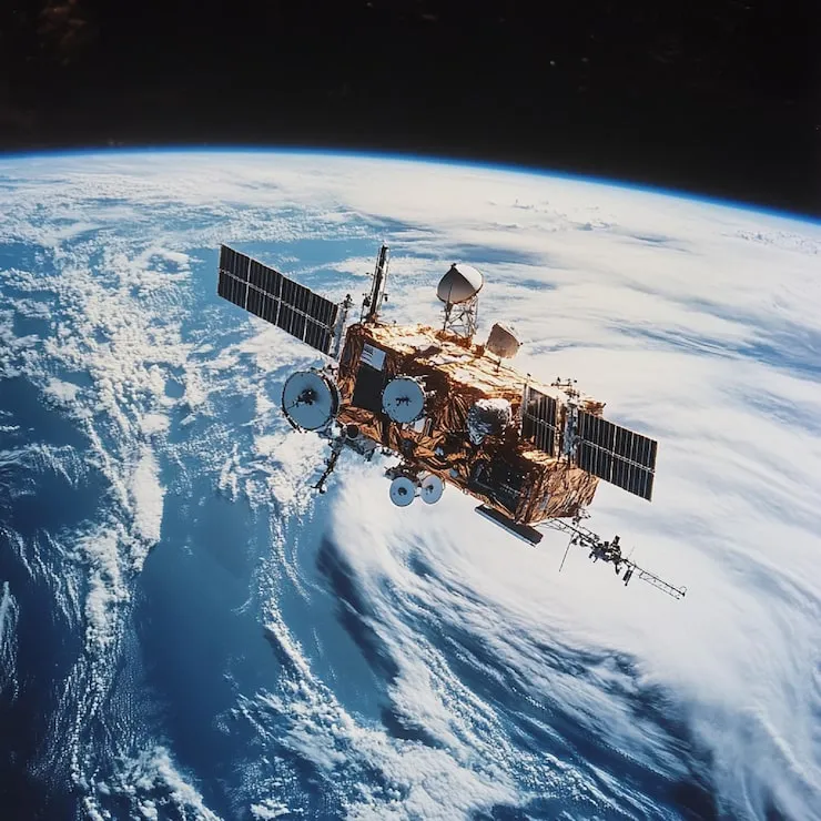

Every day, satellites orbiting Earth collect vast amounts of information about the planet. These observations help scientists monitor weather systems, environmental conditions, oceans, forests, and atmospheric activity. What may appear as simple pictures from space often contain valuable scientific data that supports research and decision-making around the world.
The growing availability of Daily Earth Images has made it easier to observe changes occurring across different regions of the planet. These images provide a consistent record of Earth’s surface and atmosphere, helping researchers identify patterns that might otherwise go unnoticed.
At the center of this process is the Earth Observation Satellite, a technology designed to monitor Earth continuously and provide insights into natural and human-driven changes.
Understanding Earth Observation Satellites
An Earth Observation Satellite is a spacecraft equipped with sensors and imaging systems that collect information about Earth from orbit. These satellites are designed to observe conditions across land, oceans, ice sheets, and the atmosphere.
Unlike traditional photography, Earth observation systems often capture data beyond visible light. Many satellites use infrared and thermal sensors to measure temperatures, moisture levels, vegetation health, and other environmental factors.
The information collected helps scientists understand how different parts of the planet are changing over time.
Because satellites operate continuously, they provide a level of global monitoring that would be difficult to achieve using only ground-based observations.
Why Daily Images Matter
Earth is constantly changing. Weather patterns evolve, ecosystems respond to seasonal conditions, and environmental events can develop rapidly.
This is why Daily Earth Images are so valuable.
Frequent observations allow researchers to compare conditions from one day to the next. Instead of relying on occasional snapshots, scientists can track changes as they occur.
Daily monitoring helps identify:
- Shifting weather systems
- Changes in vegetation
- Snow and ice movement
- Coastal changes
- Ocean conditions
- Atmospheric activity
The ability to observe these developments regularly improves both scientific understanding and environmental awareness.
Monitoring Weather And Natural Events
One of the most important uses of Earth observation satellites involves weather monitoring.
Meteorologists depend on satellite imagery to track cloud formations, storm systems, and atmospheric movement. These observations help improve forecasts and provide early warnings for severe weather events.
Satellite imagery also plays a major role during natural disasters.
Researchers and emergency teams use Daily Earth Images to monitor:
- Hurricanes
- Floods
- Wildfires
- Dust storms
- Volcanic activity
The information gathered from space helps authorities understand the scale of events and respond more effectively when necessary.
Tracking Environmental Change
Environmental conditions rarely remain static.
Forests grow and decline. Rivers shift course. Ice coverage expands and contracts. Coastal regions change over time.
An Earth Observation Satellite allows scientists to document these changes using long-term image records.
For example, satellite imagery helps researchers:
- Monitor forest health
- Study drought conditions
- Observe agricultural regions
- Measure changes in polar ice
- Track coastal erosion
By comparing images collected over months and years, scientists can identify trends that may not be visible through short-term observations.
This information supports environmental research and resource management efforts worldwide.
Understanding The Bigger Picture
One advantage of satellite observation is scale.
People on the ground typically see only a small portion of the environment around them. Satellites provide a much broader perspective.
From space, scientists can observe weather systems stretching across oceans, vegetation patterns covering entire continents, and environmental processes occurring simultaneously in different parts of the world.
This wider view helps researchers understand how Earth’s systems interact.
Atmospheric conditions influence oceans. Ocean temperatures affect weather patterns. Seasonal changes impact ecosystems across large regions.
Daily satellite observations make it possible to study these connections more effectively.
Supporting Scientific Research
Modern science depends heavily on reliable data, and satellite imagery provides one of the most consistent sources of environmental information available.
Researchers use satellite archives to study long-term trends and compare present conditions with historical records.
These observations contribute to work in areas such as:
- Climate science
- Geography
- Meteorology
- Environmental studies
- Oceanography
The availability of Daily Earth Images has improved the ability of scientists to investigate complex global processes and evaluate how conditions change over time.
The Future Of Earth Monitoring
Earth observation technology continues advancing as new satellites enter service.
Modern systems offer higher image quality, improved sensor capabilities, and more frequent observations than earlier generations. Advances in computing and data analysis also allow researchers to process large amounts of information more efficiently.
Future Earth observation missions are expected to provide even greater detail and accuracy.
As technology improves, the role of the Earth Observation Satellite will continue expanding, helping scientists monitor environmental conditions and improve understanding of global change.
Conclusion
The ability to observe Earth every day has transformed environmental research, weather monitoring, and scientific discovery. Through Daily Earth Images, researchers can track changes across land, oceans, and the atmosphere with remarkable consistency. An Earth Observation Satellite provides the continuous observations needed to study weather systems, monitor environmental conditions, and understand long-term global trends. As Earth observation technology continues to evolve, satellite imagery will remain an essential resource for exploring and understanding our changing planet.
